SYMON - Modular COMMS-ESM/COMINT System
The system SYMON is intended for very fast automated reconnaissance, direction finding, monitoring, technical analysis and localization of radio signals of interest in HF, VHF and UHF frequency bands. SYMON also uses specialized database system which is customized according to the particular customer’s requirements. The system can produce intelligence reports and formalised messages according to the national standards.
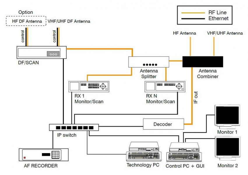
Example of system configuration is shown on Fig. 1.
SYMON is open and easily connectable to the national EW system.
The technological part is based on digital monitoring/scanning receiver IZ 225 and optional direction finder. Number of scanning receivers is given by the customer’s requirements.
Basic configuration is equipped with 2 pieces of IZ 225 receiver.
Antenna system covers frequency range from 10 kHz up to 6 GHz according to the selected modification. System is also equipped with a special AF streaming recorder for real time IP recording of AF signals from receivers.
Geographical component GEO3D is used for presentation of localization and direction finding (DF results and reporting of actual radio situation. Radio localization is included (in correlation of different DF results).
SYMON includes AKRS software application for online and offline radio signal analysis and classification with analysis of IQ raw data with bandwidth up to 500 kHz (with IZ 225 receiver) with special database structure for “self learning”. All radios are shared for different tasks, i.e. the system uses sophisticated device management for planning the operation of receivers according to the real situation during a mission (for example, all receivers can be used for monitoring or all receiver for scans or one receiver is intended for monitoring and the rest for a scan, etc.).
SW is fully developed by URC Systems with many years of experience in EW systems projects. SYMON can be easily modified according to the particular customer’s requirements. Customisation is included in the price.
SYMON is intended for an operation of both stationary and on the move. All technology is mounted on 19” rugged rack, i.e. the system is very compact and intended for easy installation into vehicle (at least SUV 4x4).
Software Architecture
Software architecture of SYMON is split into 3 categories:
1. Spectrum control software (SPECON)
2. Analysis and classfification of radio signal software (AKRS)
3. Command and control software (EWMAN, SYMON DB, SYMON MAN)
1 Spectrum control software SPECON
Control and management software is divided into three layers
- Devices control layer
- Application layer
- Presentation layer (GUI – Graphical User Interface)
1.1 Devices control layer
Implements transparent access to multiple types of measurement devices. Provides testing, configuration, measurement, results recording and device status and reports errors.
This layer is divided into standalone modules that perform a few specific jobs
- Reconnaissance module
- Monitoring module
- Direction finding module
- Station position and time synchronization module
1.2 Application layer
Implementation of system logic depends on the customer demands. It provides transparent interface for measurement layer. Integrates different measurement types (scanning, monitoring, direction finding, etc.).
1.3 Presentation layer (GUI)
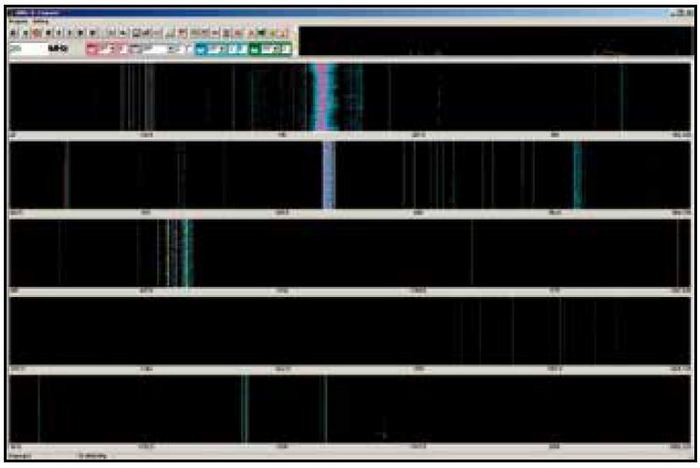
Wideband ultra fast reconnaissance PAMON GUI (see Fig. 2).
Fig. 2: Presentation of wideband scanning 20 to 2000 MHz – selection of new activities only
Narrow band reconnaissance
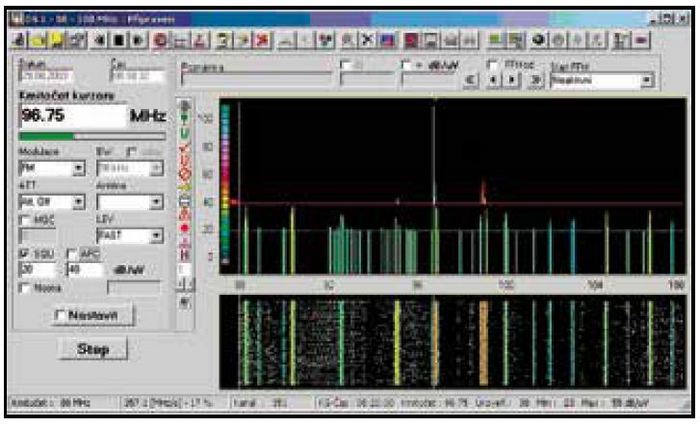
FSCAN GUI (see Fig. 3) implements presentations of scanned bands.
In band indicates
- Targets
- Disabled bands and frequencies
- Monitored channels
- Known channels with information stored in DB
Operator is able to
- Add frequency to targets list with parameters for receiver
- Add frequency to disabled frequency list
- Start or stop audio recording
- Start or stop IF recording
- Start or stop direction finding
- Get or set information about frequency
Fig. 3: Presentation of scan results
Fixed frequency monitoring
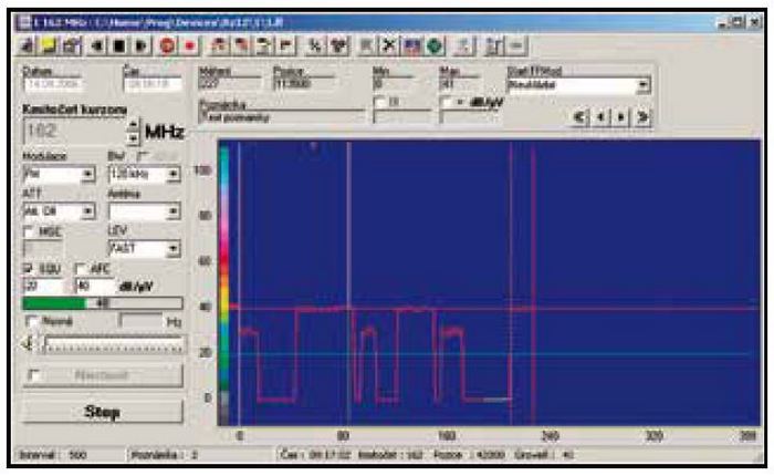
FFMode GUI (see Fig. 4) provides current level of signal, listening demodulated signal, add operator's notes with time stamps. It stores all monitored time with notes, GPS positions, and DF results into file.
Fig. 4: Monitoring of one frequency
Direction finding
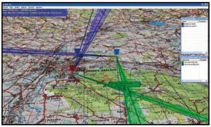
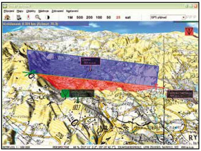
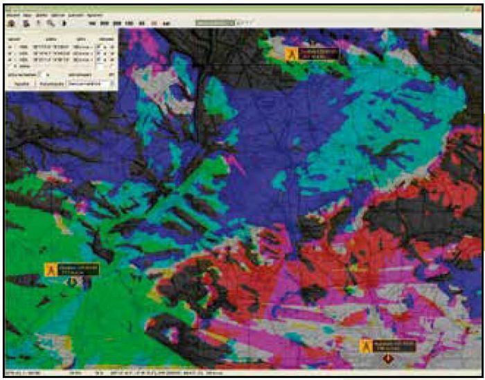
GEO3D GUI (see Fig. 5 ,Fig. 6, Fig. 7) provides results of measured targets or select sub list for visualization including DF.
Options available
- Computing point-point radio and optical visibility
- Computing radio visible area
- Make point-point relief
Fig. 5: Visualization of DF information on digital map
Fig. 6: Estimation of visibility in GEO3D
Fig. 7: Multipoint visibility in GEO3D
Analyzation Software
2 Overview
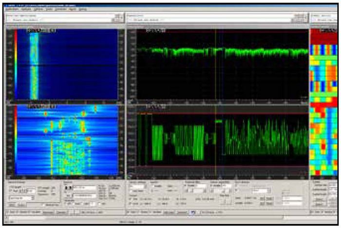
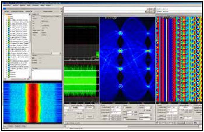
Analyzation software AKRS is intended for measurement and processing (analysis and classification) of radiosignals (Fig. 6, Fig. 7).
- On-line monitoring of channel/subband
- Digital IF signal recording
- Off-line processing of signal recordings
- Real-time analysis of known-types of radio signals
- Device and signal pattern database for analysis support
- Direct receiver control
Fig. 8: Presentation of analysis of dual modulation system (MFSK-20 in FM - F2D spectrogram of FM and FSK, demodulator of FM and FSK and part of symbol matrix)
Fig. 9: Results from NXDN (KENWOOD handheld radiostation) decoding
Command and Control Software
3 Overview
SYMON Command and Control Software includes applications SYMON DB, SYMON MAN and EWMAN as option. SYMON MAN application is intended for receiver´s management.
3.1 SYMON DB
Application SYMON DB is implemented on the top of PostgreSQL database server. This solution gives us a powerful relational database system with advanced mechanisms like triggers, stored procedures, transactions, etc. and with all the advantages of open source system. SYMON DB supports
Activities
- Frequencies of interest with jobs (what to do when)
- Disabled and own frequencies and bands
- Known frequencies
Storage for measurements
- Assets track (position with timestamp)
- Activities (frequencies of interest)
- DF results (frequencies of interest)
- IF and Audio files (frequencies of interest)
Geo3D objects
- Secure places
- Points of interest
- Dangerous areas
3.2 EWMAN
The sofware application EWMAN provides tools for commanders in planning and decision making process, during working cycle as well as in the reviewing and reporting stage on EWCC (EW Coordination Cell).
Using GUI the commander is able to define own operational units and its technical equipment which is used in a mission. Every technical device has its technical parameters, that may be also defined in database.
Most important feature of the GUI is task planning capability. The commander is able to create a new task for his stationary or mobile unit. Mission objective is defined by several criteria, e.g. start date, end date, known frequencies, dangers, restrictions, jamming tasks, special requirements, GPS route, etc. There is also an option to group several tasks together into a “super-task”. This becomes useful when planning a task for convoy of differently equipped vehicles.
Reporting tool is another important module in the system. It provides commander with tools for gathering statistical and analytical data stored in the database. The data can be filtered and sorted on various criteria, it can be merged together with pictures, graphs and other additional information into a complex report.
EWMAN application includes GEO3D component intended to capture, store, manipulate, analyze, manage, and present of geographical data and objects.
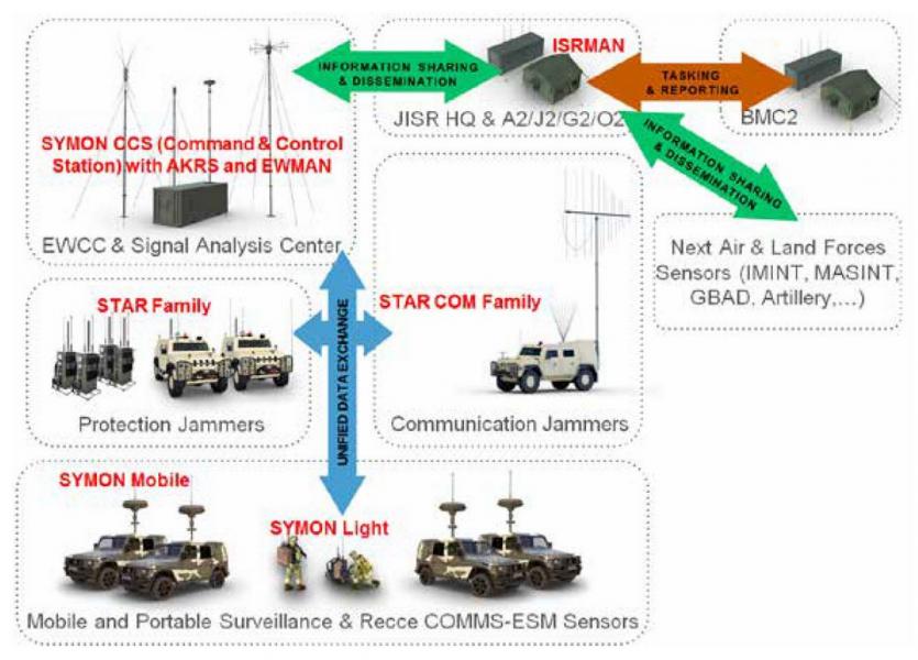 Fig. 10: Complex EW & JISR URC Systems solution

